Land Cover in National Parks
Select a national park to view its image and coverage data.
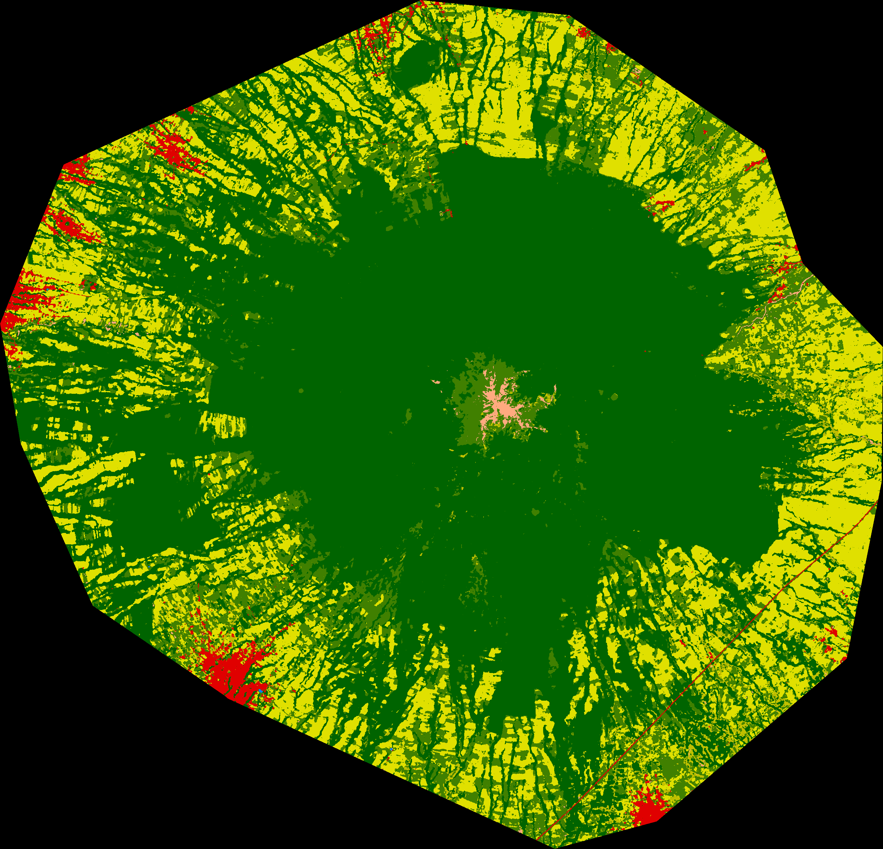
| Coverage Type | Percentage (%) | Area (km²) | Color |
|---|---|---|---|
| Tree cover | 59.6 | 275 | |
| Shrubland | 1.9 | 8 | |
| Grassland | 14.7 | 67 | |
| Cropland | 21.8 | 101 | |
| Built-up | 1.7 | 7 | |
| Bare / Sparse vegetation | 0.3 | 1 | |
| Snow and Ice | 0.0 | 0 | |
| Permanent water bodies | 0.0 | 0 | |
| Herbaceous Wetland | 0.0 | 0 | |
| Mangrove | 0.0 | 0 | |
| Moss & Lichen | 0.0 | 0 |
La Montaña Malinche or Matlalcuéyatl National Park, covering 462.77 km², is located in central Mexico. This inactive volcano reaches a significant height and features predominantly forest coverage, with 59.62% forest cover, complemented by grasslands (14.67%) and agricultural areas (21.84%). Its characteristic vegetation includes pine-oak forests in various states of conservation. The main challenges include pressure from agricultural activities occupying more than 21% of its surface, as well as urban expansion representing 1.67% of the area. There is a gradual degradation of forested areas due to illegal logging and land-use change, requiring urgent conservation and ecological restoration actions.