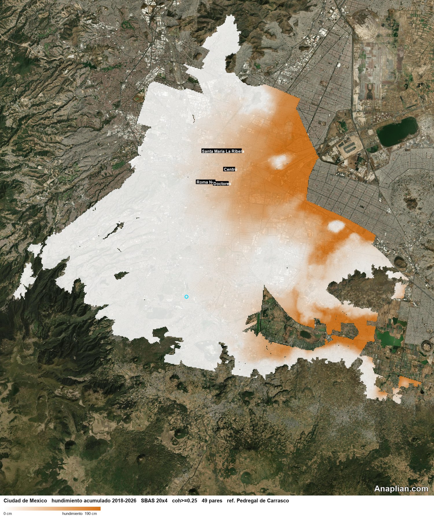
This map shows cumulative subsidence in Mexico City between September 2018 and September 2026, measured with Sentinel-1 radar. The reference is Pedregal de Carrasco.
The sinking follows the shape of the former lakes of Texcoco, Chalco and Xochimilco: Venustiano Carranza, Iztacalco, and the lacustrine parts of Iztapalapa, Tláhuac and eastern Gustavo A. Madero. The south and southwest, of volcanic or hill origin, stay stable. The centre, including Cuauhtémoc, sinks, but less: it is the transition zone, not bedrock.
The scale reaches 1.4 m. That darkest colour means at least that much. Over eight years, the median in Venustiano Carranza is about 1.5 m, and its fastest zone approaches 2 m. Areas with no movement shown are places the method cannot measure a possible sinking, or that were extensively built, or that are mainly vegetation.
Groundwater extraction is the main explanation. As aquifer pressure drops, lake clay compacts. The thicker the clay, the greater the subsidence.
Where a volcanic hill meets the clay, the ground stretches and cracks: around Peñón de los Baños, Peñón del Marqués and the slopes of Sierra de Santa Catarina. Fractures, steps and small landslides appear there. As the slope is lost, water no longer drains, sewers break where movement is uneven, and leaks open sinkholes.
Subsidence in clay soils does not cause the earthquake. In an earthquake, though, shaking is felt more strongly there and can also settle the ground at once or shift a crack that was already open.